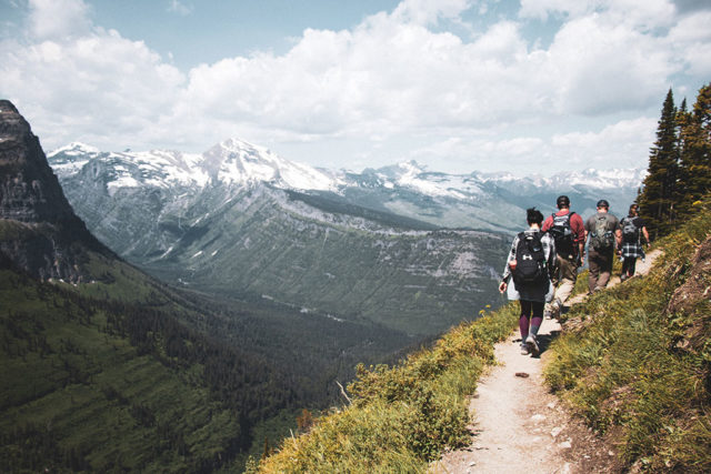
Hiking is a great activity for everyone, regardless of skill level. It’s a great way to get up close and personal with nature, without necessarily having to get too far off the grid. The Phoenix area is a great spot to hike – offering many trails with different sorts of terrain and beautiful views. Here are seven hikes near Phoenix that we recommend:
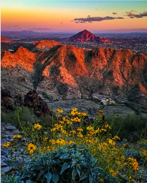
Photo Credit: Patrick_Bulger
Piestewa Peak Summit Trail
Location: 302 Trailhead, 5994 E. Squaw Peak Dr.
Difficulty Level: Difficult
Route Type: Out and back
Elevation Gain: 1,151 ft
Distance: 2.2 miles
This busy trail attracts hikers and runners alike, who are up for a challenge and want to stay close to the city. This trail has beautiful wild flowers and gorgeous views you can stop and admire, along your way up to one of the highest peaks (also known as Squaw Peak) in the Phoenix Mountains. Keep in mind, this hike is not for beginners.
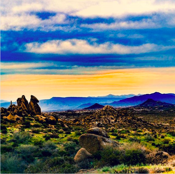
Photo Credit: MySublimeSpace
Tom’s Thumb Trail
Location: 23015 N 128th St, Scottsdale, AZ, 85255
Difficulty Level: Difficult
Route Type: Out and back
Elevation Gain: 1,236 ft
Distance: 4 miles
Tom’s Thumb is a granite “bump”rock formation along this trail that’s around 1 billion years old. Yes, BILLION. The surface on this trail is smooth and well-marked. You’ll see interesting rock formations, birds and beautiful wild flowers along your hike, as well as a great view of Phoenix. Definitely plan on bringing your own water on this hike, as there is none available at the trailhead. Dogs are welcome on this hike, as long as they’re on a leash.
Photo Credit: Chasin_Tales
Quartz Loop Trail
Location: Cave Creek National Park – 37019 N Lava Ln, Cave Creek, AZ 85331
Difficulty Level: Moderate
Route Type: Loop
Elevation Gain: 406 ft
Distance: 3.5 miles
This trail is open to dogs, bikes, horses and plain ol’ hikers. In addition to the domesticated animals you might encounter on your hike, there’s a pretty good chance that you’ll see some wildlife as well. Quartz Loop is accessed via Go John or Slate trail and promises gorgeous views to the north and east. This trail is one of the most popular in Cave Creek, yet traffic is light most of the time.

Photo Credit: Tomvanerark
Deem Hills Circumference Trail
Location: Deem Hills Recreation Area, 5050 W Andrea Ln, Phoenix, AZ 85083
Difficulty Level: Moderate
Route Type: Loop
Elevation Gain: 784 ft
Distance: 5.6 miles
Deem Hills Circumference Trail is the perfect loop for a beginning to moderate hiker. This rocky trail is secluded enough that you won’t feel like you’re close to the city. Horses, bikers and dogs are all welcome on this trail, so be mindful of that. If you feel you’re in need of a more intense hike, check out the more difficult Ridgeline Trail.
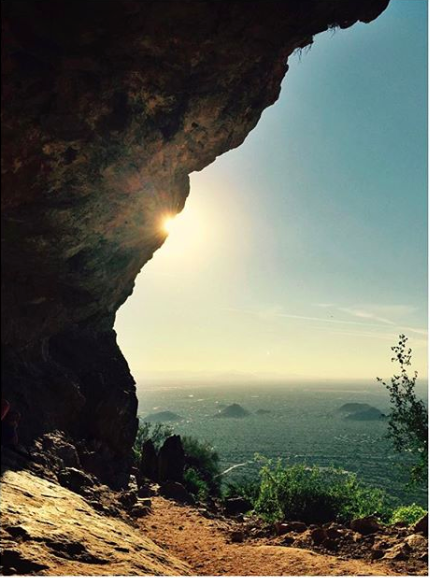
Photo Credit: HollyAZSun
Wind Cave Trail
Location: Usery Mountain Regional Park, 3939 Usery Pass Rd, Mesa, AZ 85207
Difficulty Level: Moderate
Route Type: Out and back
Elevation Gain: 770 ft
Distance: 2.6 miles
This winding and weaving trail leads you past some beautiful cacti and, as the title suggests, to a cave, with breathtaking views of the west and the north. Some pro-tips for this hike — bring your sunscreen and a hat, as there’s not a ton of shade, and be sure to bring your bug spray, this trail can get buggy! Also, leashed pooches are welcome.
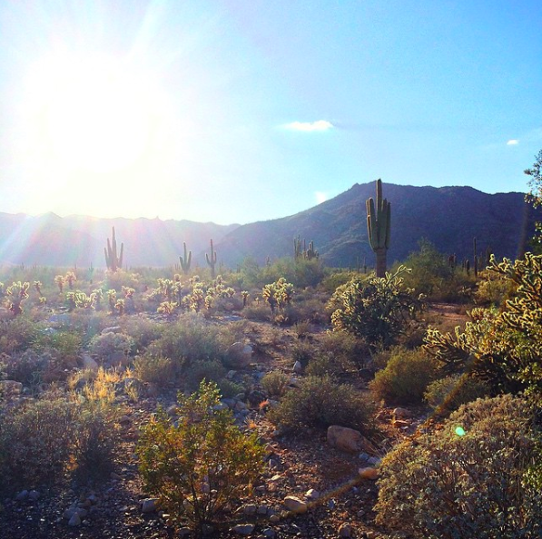
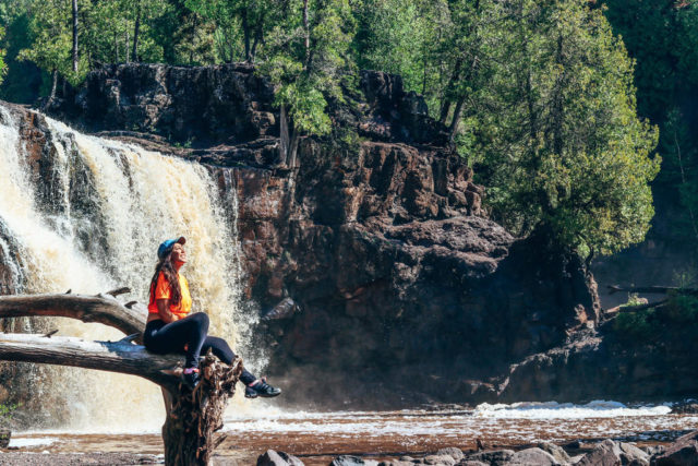
Photo Credit: Justine.McGraw
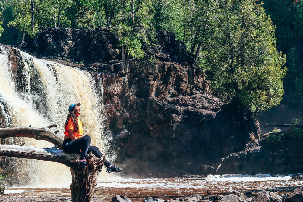
Waterfall Canyon Trail
Location: White Tank Mountain Regional Park, 20304 W White Tank Mountain Rd, Waddell, AZ 85355
Difficulty Level: Easy
Route Type: Out and back
Elevation Gain: 354 ft
Distance: 1.8 miles
This hike is quick and good for hikers of all skill levels. It’s flat and kid friendly. At the end of the trail is a – you guessed it – waterfall. Just know that the waterfall is only flowing if there’s been a recent rain. A nice thing about this hike is you can do it at night too, just bring a flashlight and some bug spray, as well as a scorpion light.

Photo Credit: CityOfPhoenixAZ
Alta and Bajada Trail
Location: South Mountain Park, 10919 S Central Ave, Phoenix, AZ 85042
Difficulty Level: Difficult
Route Type: Loop
Elevation Gain: 1,601 ft
Distance: 7.7miles
If you’re looking for some peace and quiet on your hike, this lightly trafficked trail is for you. While the trail is more difficult, it’s worth the hike for stunning canyon and mountain views you’ll see along your journey. You are welcome to bring your dog on this hike, as long as he’s a very good boy and stays on his leash.
follow the adventure
Straight To Your Inbox: Vans for Sale. Rental Deals. Latest Stories From The Road.
#VOYAGERVAN
Where Will The Voyager Van Take You?


Leave A Comment